The Korean War, which lasted from 1950 to 1953, remains one of the most defining conflicts of the 20th century. Its legacy continues to shape the geopolitics of East Asia. Among the many locations tied to the war’s legacy, Panmunjom stands out as the most iconic. Situated near the 38th parallel, Panmunjom became the symbol of armistice, negotiation, and the lingering divide between North and South Korea. Understanding the Korean War map, especially the role of Panmunjom, provides valuable insight into military strategy, international diplomacy, and ongoing tensions on the Korean Peninsula.
Geographic Significance of Panmunjom
Panmunjom, though often referred to as a village, is more accurately known today for the Joint Security Area (JSA), which straddles the Military Demarcation Line (MDL) between North and South Korea. It is located in the Demilitarized Zone (DMZ), a buffer zone established at the end of hostilities. The village itself lies roughly 50 kilometers north of Seoul and about the same distance south of Pyongyang, making it an ideal meeting point between the two Koreas.
The Role of Panmunjom in the Korean War
During the Korean War, intense fighting along the 38th parallel created a need for a neutral location to discuss ceasefire terms. In 1951, Panmunjom was chosen as the site for armistice talks. The location was significant because it lay between enemy lines, allowing both North Korean and United Nations Command delegations to access it with relative security.
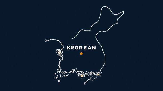
The Korean War Map and the 38th Parallel
Before the war, Korea was divided along the 38th parallel after World War II, with Soviet forces occupying the North and American forces in the South. When North Korea invaded the South in June 1950, the boundary shifted repeatedly throughout the conflict. Maps of the Korean War show dramatic advances and retreats, with frontlines stretching from the southern tip of the Korean Peninsula near Pusan to the northern border with China along the Yalu River.
However, after years of back-and-forth combat, a military stalemate developed near the original dividing line. This line eventually became the basis for the Military Demarcation Line, which passes through Panmunjom. The Korean War map thus evolved into a fixed symbol of division, rather than one of conquest or defeat.
Establishment of the Demilitarized Zone
With the signing of the Korean Armistice Agreement on July 27, 1953, a Demilitarized Zone (DMZ) was created. It spans roughly 250 kilometers across the peninsula and is about 4 kilometers wide. At its center lies Panmunjom, the only location where direct communication and interaction between North and South Korean forces officially take place.
Military Demarcation Line (MDL)
The MDL runs through the middle of the DMZ and represents the actual boundary between North and South Korea. The line is heavily guarded on both sides, but Panmunjom allows for rare diplomatic meetings, including military negotiations and high-level talks between the two Koreas.
Modern Relevance of Panmunjom
Though the Korean War ended in an armistice and not a peace treaty, Panmunjom remains an active site for diplomacy. It has hosted numerous historical moments, including the 2018 summit between South Korean President Moon Jae-in and North Korean leader Kim Jong-un, who crossed the MDL on foot in a highly symbolic gesture.
Tourism and Education
Panmunjom is also a significant educational and tourism site. Many visitors to South Korea take guided tours of the DMZ and JSA, where they can see the blue buildings that house negotiation tables, with one half of the table in North Korea and the other in the South. The Korean War map comes alive here, giving people a tangible sense of the geography, tension, and fragile peace that persists.
The Impact on Regional Stability
The strategic importance of Panmunjom extends beyond its geography. It reflects the broader security dynamics in East Asia, involving not only the Koreas but also the United States, China, Russia, and Japan. The Korean War map, with Panmunjom as its focal point, illustrates the unresolved conflict and the urgent need for ongoing diplomatic engagement.
Continued Military Presence
Despite the armistice, both North and South Korea maintain strong military presences along the DMZ. The Korean War map continues to guide military planning and defense postures. Panmunjom, being a critical chokepoint, is constantly monitored and fortified, reflecting the persistent risk of conflict escalation.
Cartographic Representations of the Conflict
Historical and modern maps of the Korean War often use Panmunjom as a central reference point. These maps not only show battle lines but also document the human cost of the war refugee flows, prisoner-of-war camps, and the division of families. The visual representation of Panmunjom and its surroundings highlights its unique status as both a front line and a peace zone.
Use in Academic and Military Studies
Researchers, historians, and military strategists continue to use Korean War maps in their work. Panmunjom features prominently in these studies because of its role in diplomacy and deterrence. Understanding the physical layout of the JSA helps in comprehending broader patterns of Cold War confrontation and post-war peacebuilding efforts.
Future of Panmunjom and the DMZ
There have been ongoing discussions about transforming Panmunjom and the broader DMZ into a peace park or a UNESCO World Heritage Site. While political realities make such developments complex, the idea reflects hope for a future where Panmunjom represents unity rather than division.
Challenges Ahead
- Political mistrust between North and South Korea
- Influence of external powers like the US and China
- Lack of a formal peace treaty
- Continuing nuclear tensions on the Korean Peninsula
Nevertheless, the symbolism of Panmunjom continues to inspire peace advocates and remains a focal point for any potential reconciliation.
The geographic location of Panmunjom on the Korean War map is not just a marker of past conflict it is a symbol of enduring complexity and fragile hope. Its strategic placement, historical importance, and continued relevance make it one of the most important places in the modern history of Korea. For those studying the Korean War, Panmunjom is essential for understanding not only where the war ended, but where peace could potentially begin. The legacy of Panmunjom, framed by the Korean War map, continues to be written by leaders, soldiers, and ordinary people seeking lasting resolution in a divided land.